Signs and markings of the Löwenpfade
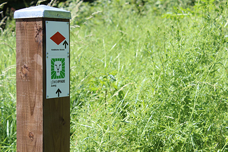
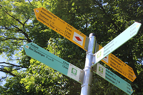
Our Löwenpfade are all circular hiking trails that can be walked in both directions. The signs and markings are therefore in both directions.
Just try it and do the tour the other way around. You will be amazed at the completely new perspectives offered to you.
At the start of each Löwenpfad, varyiing between 3 and 24 kilometers, you will find a detailed information board with information about the route, an elevation profile and the sights along the way.
All tours are available for you to download on your smartphone via the tour planner of Göppingen (German website): www.tourenplaner.lk-gp.de.
Please keep in mind: You may not find gastronomy on every route. Therefore, when planning your tour, remember to take an appropriate amount of refreshments and snacks with you.
At each pole with a location indication you will find a so-called location plaque with a unique location number, location designation and corresponding UTM coordinates. In the event of an emergency, please call 112 and provide either the site number or UTM coordinates so that emergency services can pinpoint the exact location.


